
Overview
Beyond crystal-clear waters, powdery white beaches, colourful fishing villages, and iconic local delicacies like nasi dagang, keropok lekor, sata, and nekbat, Terengganu is one of the best destination in Malaysia for forest hiking and trails – with more than 80 hiking spots according to All Trail experts and travellers.
Hidden within ancient rainforests, rolling hills, and protected forest reserves are some of Malaysia’s most rewarding hiking trails. From leisurely sunrise hikes overlooking the South China Sea to demanding jungle expeditions that ascend peaks above 1,000 metres, Terengganu offers outdoor adventures for hikers of every experience level.
Whether you’re looking to reconnect with nature, soak in panoramic viewpoints, discover hidden waterfalls, or simply escape the pace of city life, these trails offer fresh mountain air, spectacular scenery, and a chance to experience a wilder side of the state that’s often overlooked.
In this guide, we’ve rounded up the best hiking in Terengganu, within close proximity to beachfront Katsetiu Villas, complete with each trail’s elevation, hiking distance, difficulty level, permit or entrance fees, and everything else you need to plan your next adventure.
Whether you’re a first-time hiker or an experienced trekker seeking your next challenge, there’s a trail in Terengganu that’s worth adding to your bucket list. So let’s check it out!
Terengganu Hiking Trails — Fees & Permit Summary
| Trail Name | Fee | Permit Required | Guided / Self Tour |
|---|---|---|---|
| Blue Pool, Lata Payung, Setiu | RM10 entrance fee + RM5 forest permit (only if continuing to Gunung Sarut) | No* | Self Tour |
| Gunung Sarut, Setiu | RM5 forest permit (JPNT) + separate MGP guide fee | Yes | Guided Tour (MGP mandatory) |
| Lata Ulu Kasar, Setiu | RM5 forest permit (JPNT) + separate local guide fee | Yes | Guided Tour |
| Lata Ulu Kekabu, Setiu | RM10 forest permit (JPNT) + separate Malim Gunung guide fee | Yes | Guided Tour (Malim Gunung mandatory) |
| Bukit Bubus, Besut | Free | No | Self Tour |
| Bukit Maras, Kuala Nerus | Free | No | Self Tour |
| Bukit Keluang, Besut | Free | No | Self Tour |
| Bukit Tok Salai, Sungai Nerus | Free | No | Self Tour |
| Bukit Besar Hiking Network, Kuala Terengganu | Free | No | Self Tour |
| Bukit Chendering, Kuala Terengganu | Free | No | Self Tour |
*Blue Pool itself requires no permit — the RM5 forest permit and mandatory MGP guide only apply if continuing beyond Blue Pool to the Gunung Sarut summit.
1. Blue Pool, Lata Payung, Setiu
Blue Pool, Lata Payung, Setiu — Trail Info at a Glance
Distance from Katsetiu Villas
~25–30 min drive
Level
Beginner
Elevation
Lowland rainforest river pool (not a summit hike)
Trail Distance
Approx. 40–45 minutes' walk (one way)
Fee
RM10 entrance fee to Taman Eko Rimba Lata Payung + RM5 forest permit
Guided Tour / Self Tour
Guided Tour (with permit pass)
Opening Hours
8AM – 5PM
Google Reviews
4.6 — Google Maps
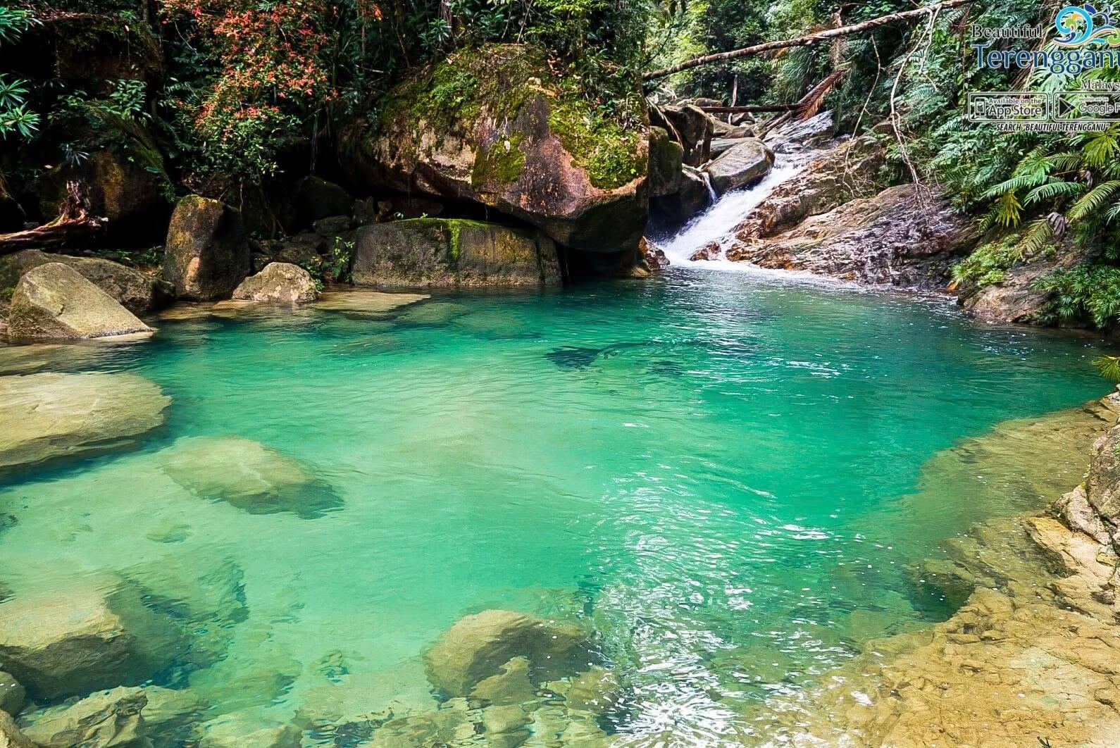
Hidden within the lush rainforest of Taman Eko Rimba Lata Payung, Blue Pool (or Blue Lagoon) is one of Setiu’s most beautiful natural attractions – often viewed as a hidden gem away from mass tourism that appeals to first time hikers to even experienced hikers.
Reached via a scenic 40–45 minute jungle walk, the trail follows forest paths and river crossings before arriving at a crystal-clear natural pool surrounded by unspoilt tropical rainforest.
Although it forms part of the route to Gunung Sarut (Sarut Mountain), Blue Pool (Blue Lagoon) at Lata Payung has become a popular adventure destination in Terengganu. Many visitors make the journey simply to enjoy the refreshing water, tranquil surroundings, and striking blue hues that give the pool its name.
The trail lies within the Hutan Simpan Hulu Nerus, a Permanent Reserved Forest managed by the Terengganu Forestry Department (JPNT). As the trail is located within a protected forest reserve, visitors should ensure they comply with current JPNT access requirements, fees and always prioritise safety, particularly during periods of heavy rainfall.
Guided Tour: Not required. Visitors may explore Blue Pool independently within the Taman Eko Rimba recreation area. Those continuing to Gunung Sarut must be accompanied by a registered Malim Gunung Perhutanan (MGP).
Permit required: No, just the RM10 park entrance fee. Permit rules only apply if you continue on to Gunung Sarut.
Advance Booking: No advance booking needed, pay the entrance fee at the park counter on arrival.
- Best for: Families, nature lovers, photographers, and visitors looking for a short rainforest adventure without climbing a mountain
- Highlights: Crystal-clear natural pool with striking blue hues, rainforest trekking, river crossings, lush tropical forest, and a peaceful natural setting
- Local tip: Water levels can rise rapidly after heavy rain, and the area is susceptible to kepala air (flash floods).
- Best time to Visit: March to October. Always check weather conditions before your visit and avoid the trail during the November to March monsoon season.
2. Gunung Sarut, Setiu
Gunung Sarut, Setiu — Trail Info at a Glance
Distance from Katsetiu Villas
~25–30 min drive to the Lata Payung trailhead
Level
Intermediate–Hard
Elevation
1,229 m
Trail Distance
~12–14 km (estimated, return) • 5–7 hrs, or 2D1N with camping
Fee
RM5 forest permit (JPNT). Mandatory MGP guide fee charged separately
Guided Tour / Self Tour
Guided Tour — registered Malim Gunung Perhutanan (MGP) mandatory
Opening Hours
Advance booking required — arrange guide & permit with JPNT before your trip
Google Reviews
4.4 — Google Maps
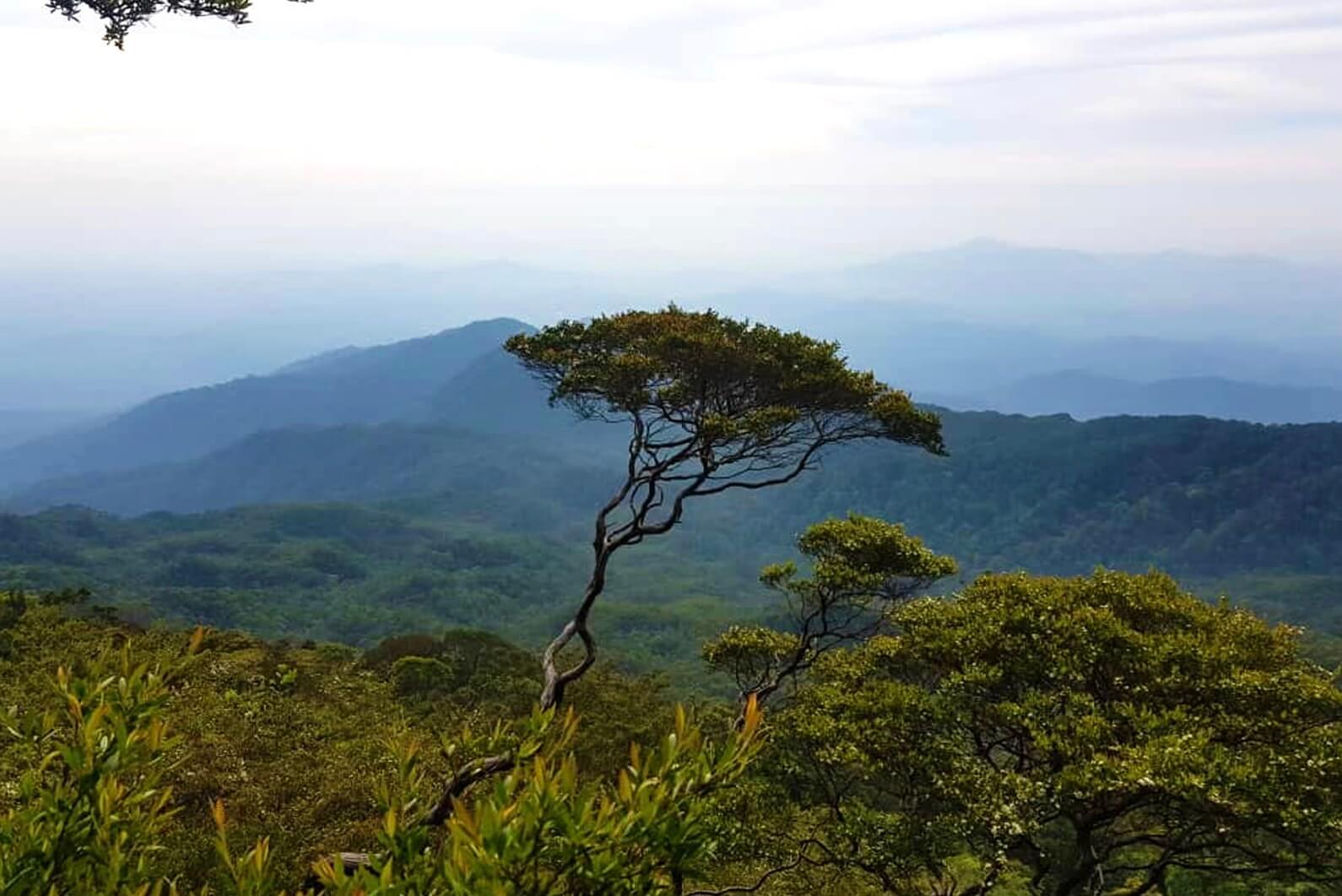
Gunung Sarut is one of Terengganu’s hidden mountain gems, offering a rewarding rainforest hiking adventure away from the crowds.
Suitable for intermediate or experienced hikers, the hike begins at Lata Payung checkpoint, where a 40–45 minute jungle trek (guided by a certified hiker) leads to the picturesque Blue Pool (Blue Lagoon) – where you can swim and take a dip before the ascent towards the summit.
Along the route, hikers pass through lush tropical rainforest, climb to the scenic Bonsai Campsite, and enjoy panoramic viewpoints overlooking the surrounding forest before reaching the summit.
Although Gunung Sarut stands higher than Gunung Tebu at 1,229 metres, many hikers consider its trail to be less technical, making it an excellent choice for those looking to tackle a high peak without the demanding terrain of Gunung Tebu.
Hikers should take extra care when crossing the Blue Pool area, as water levels can rise rapidly after heavy rain – particularly during monsoon season.
Whether completed as a challenging day hike or a relaxing 2D1N camping trip, Gunung Sarut is a fantastic adventure for hikers seeking a quieter and more remote mountain experience in Terengganu.
Guided Tour: A registered Malim Gunung Perhutanan (MGP) guide is mandatory for Gunung Sarut.
Permit required: Yes. RM5 Terengganu Forestry Department permit, required alongside the mandatory MGP guide.
Advance Booking: Advance booking required, arrange your MGP guide and permit with the Forestry Department or a local guide operator before your trip, especially for weekend or camping dates.
- Best for: Intermediate and experienced hikers, campers, and nature lovers seeking a quieter alternative to Gunung Tebu
- Highlights: Blue Pool river, Bonsai Campsite, scenic viewpoints before the summit, lush rainforest, and one of Terengganu’s highest peaks
- Local tip: The mountain is closed during the monsoon season (November–March) due to the risk of flash floods. Although Gunung Sarut is higher than Gunung Tebu, its trail is generally considered less challenging. Hiring a licensed mountain guide is strongly recommended.
Additional Notes
- Blue Pool: A picturesque natural pool about 40–45 minutes from Lata Payung, known for its crystal-clear water that occasionally appears deep blue.
- Bonsai Campsite: Located at approximately 800 m elevation, accommodating around 60–80 campers, with a nearby stream providing a reliable water source.
- Summit Push: From the campsite, it takes 1.5–2 hours to reach the summit, passing two panoramic viewpoints before arriving at the forested peak.
3. Lata Ulu Kasar, Setiu
Lata Ulu Kasar, Setiu — Trail Info at a Glance
Distance from Katsetiu Villas
~25–35 min drive
Level
Beginner
Elevation
Low-lying river recreation area (not a summit hike)
Trail Distance
Short riverside walk from the car park to the pools
Fee
RM5 forest permit (JPNT). Local guide fee from Ulu Kasar Adventure Park charged separately
Guided Tour / Self Tour
Guided Tour — led by local guides from Ulu Kasar Adventure Park
Opening Hours
Advance booking required to secure your preferred date and time
Google Reviews
4.4 — Google Maps
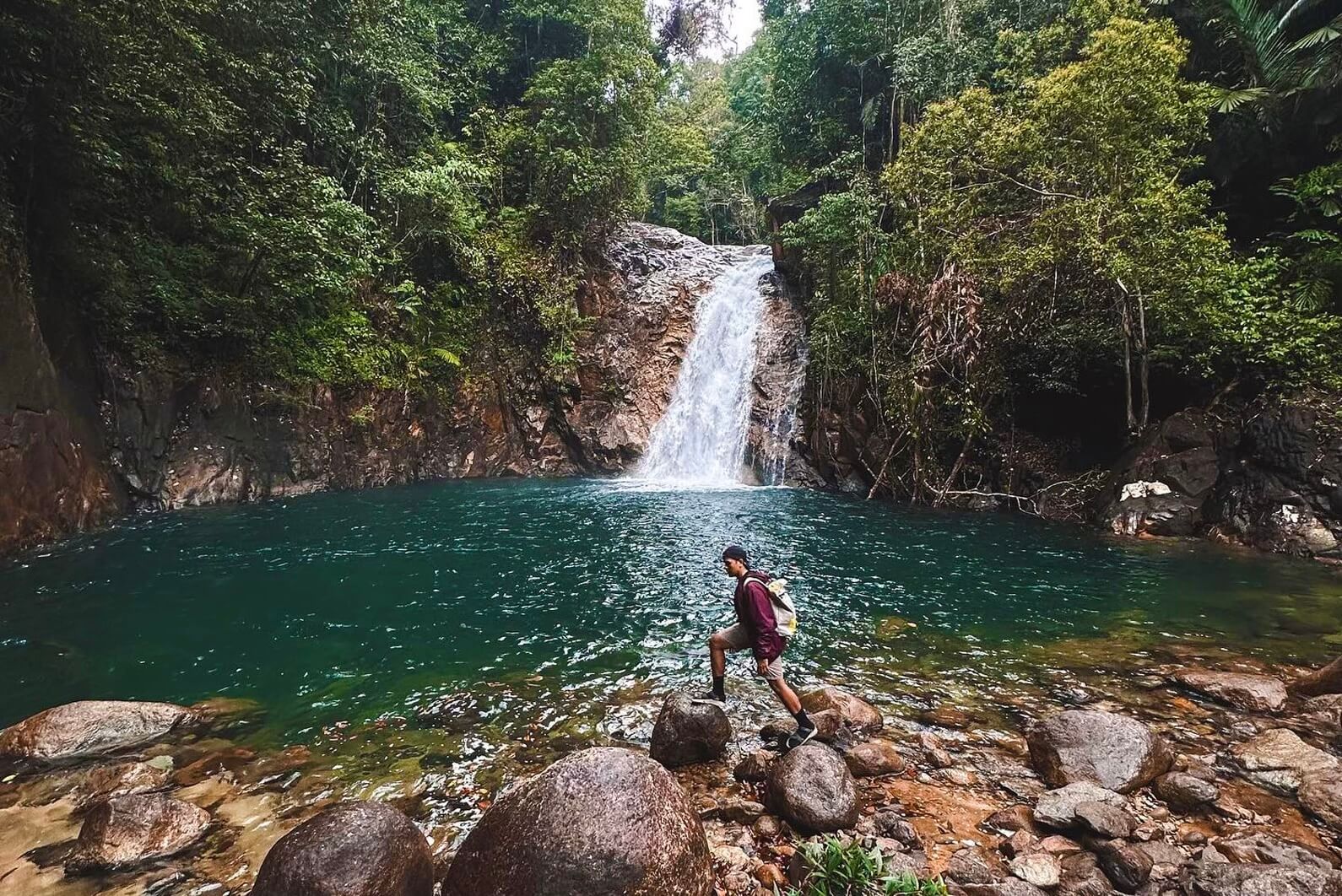
Lata Ulu Kasar is a low-key river recreation spot rather than a hiking summit, but it’s often paired with nearby Lata Payung and the Blue Pool trail as part of a longer forest hiking in Setiu, Terengganu. Its shallow, calm pools make it popular with local families and travellers, while flat grassy areas are used for picnics and barbecues – which can be busy on weekends or school holidays.
Terengganu’s Fire and Rescue Department (JBPM) has listed Lata Ulu Kasar as one of 22 flash-flood-risk spots in the state, so visitors should avoid the area during heavy rain and always heed on-site safety notices. Because the site falls within a Hutan Simpanan Kekal (Permanent Forest Reserve) managed by the Terengganu Forestry Department (JPNT), any recreational visit technically requires an entry permit — apply through the relevant Pejabat Hutan Daerah before your trip, the same requirement that applies to other forest-reserve waterfalls in this guide.
Guided Tour: All activities are led by experienced local guides provided by Ulu Kasar Adventure Park.
Permit required: Yes. RM5 hiking/entry permit, as the site sits within a Hutan Simpanan Kekal (Permanent Forest Reserve).
Advance Booking: Advance booking is required to secure your preferred date and time.
- Best for: Families, swimming, picnics, and a relaxed nature escape
- Highlights: Shallow natural pools, waterfall, gazebos, riverside camping and chalets, and a peaceful forest setting, visit the Sanctuary Ikan Kelah and feed the fish
- Local tip: Listed by JBPM as a flash-flood-risk spot during monsoon (Nov – Jan) — avoid during and after heavy rain.
4. Lata Ulu Kekabu, Setiu
Lata Ulu Kekabu, Setiu — Trail Info at a Glance
Distance from Katsetiu Villas
~25–35 min drive (estimated)
Level
Beginner
Elevation
Low-lying river area (not a summit hike)
Trail Distance
Short walk-in from the nearest access point
Fee
RM10 forest permit (JPNT, payable online). Guide (Malim Gunung) fee charged separately
Guided Tour / Self Tour
Guided Tour — registered Malim Gunung mandatory
Opening Hours
Advance booking required to ensure guide availability and access
Google Reviews
4.8 — Google Maps
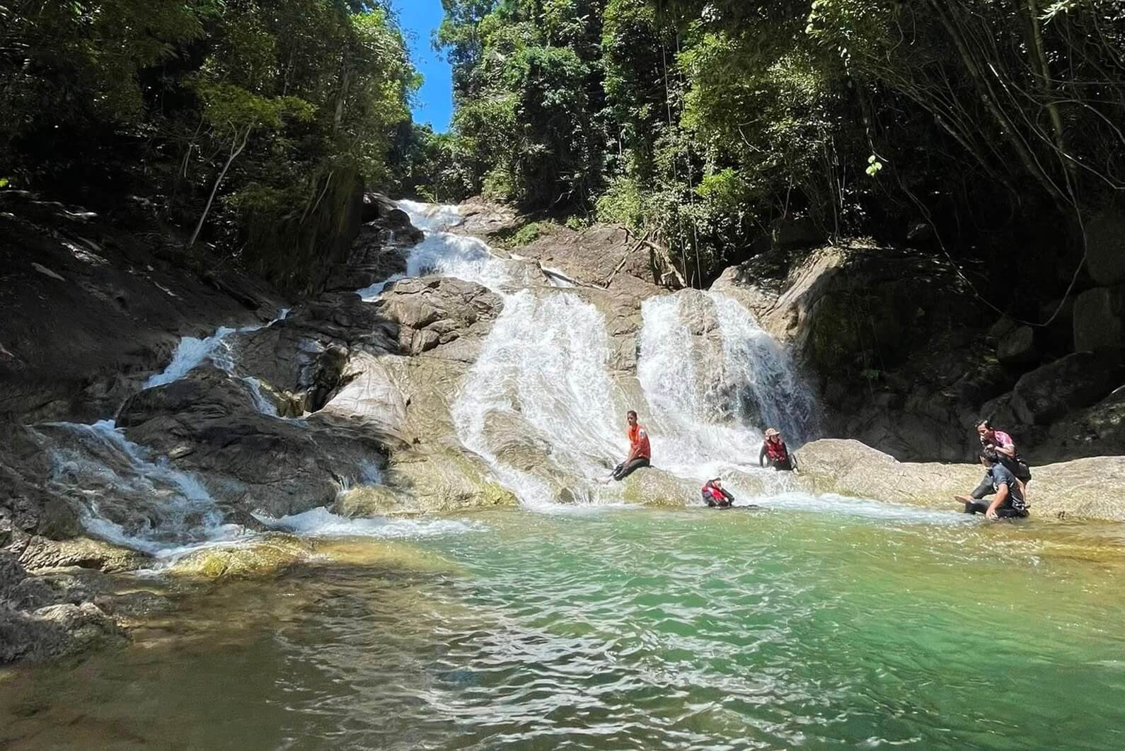
Lata Ulu Kekabu is one of Setiu’s newest community-tourism destinations, promoted by the state government for its pristine, untouched condition — officials have specifically highlighted that its trees and boulders remain in their natural state.
Hikers can enjoy a short forest hiking route, suitable for beginners with no experience and the best way to experience outdoor adventure forest travel in Terengganu without too much hassle. The local guides will bring you through a 5km walk, mainly flat surfaces through crystal clear rivers.
It sits in the same general river ecosystem as Lata Ulu Kasar and Lata Payung, making it possible to combine several of Setiu’s waterfall spots in one hiking trip.
Guided Tour: A registered Malim Gunung (licensed mountain guide) is mandatory when entering the forest reserve.
Permit Required: Yes. RM10 forest-reserve permit (payable online), required alongside the mandatory registered guide.
Advance Booking: Advance booking is required to ensure guide availability and access arrangements.
- Best for: Nature lovers wanting an untouched, less-visited river spot
- Highlights: Clear, cold river pools and untouched forest boulders
- Local tip: Still a very low-key, community-run site with minimal facilities — go with a local guide if you can, and be prepared for a rustic, authentic forest bathing experience.
5. Bukit Bubus, Besut
Bukit Bubus, Besut — Trail Info at a Glance
Distance from Katsetiu Villas
~30–40 min drive
Level
Beginner
Elevation
~85 m
Trail Distance
1.2 km out-and-back • 30 min – 1 hr
Fee
Free
Guided Tour / Self Tour
Self Tour — well-marked trail, no permit required
Opening Hours
No advance booking needed
Google Reviews
4.5 — Google Maps
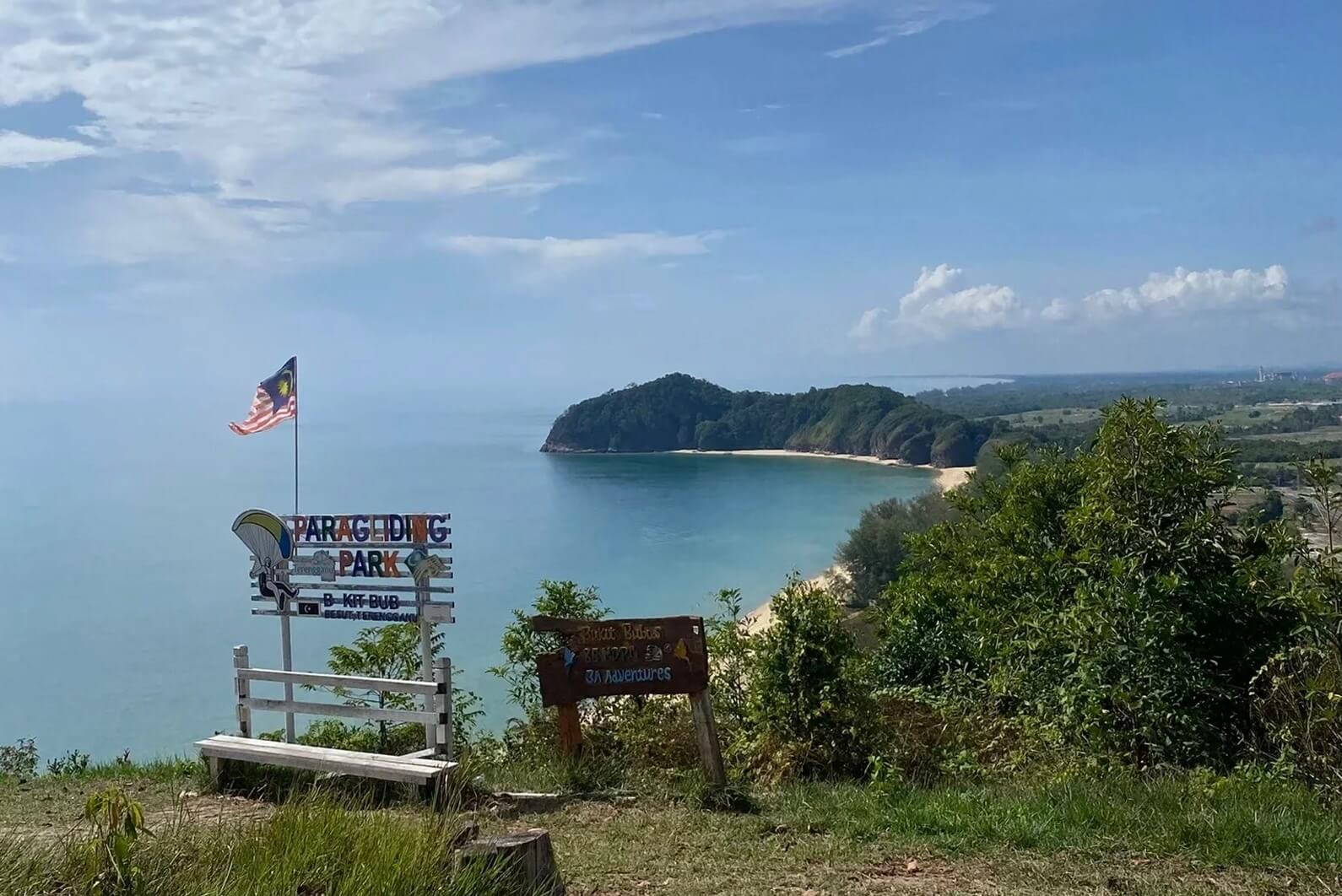
Perched on a low hill near Kampung Raja in Besut, Bukit Bubus is one of Terengganu’s most beginner-friendly hiking destinations. The short, mostly paved trail winds gently uphill through light forest before reaching a scenic summit, making it suitable for hikers of all ages and fitness levels. Despite its modest elevation, the hill rewards visitors with sweeping views of the surrounding countryside, coastline, and nearby UniSZA Besut Campus.
Bukit Bubus is also a popular paragliding launch site, with colourful canopies often seen soaring above the coastline when wind conditions are favourable. Whether you’re looking for a quick morning workout, a peaceful spot to watch the sunrise, or simply a relaxing outdoor escape, Bukit Bubus offers a rewarding hiking experience without the demanding climbs found on Terengganu’s higher mountains.
Guided Tour: Not required. The trail is well-marked and suitable for self-guided hikes.
Permit Required: No permit required.
Advance Booking: Not required.
- Best for: Beginners, families, sunrise seekers, and paragliding spectators
- Highlights: Panoramic coastal views, paragliding launch site, sunrise viewpoints, paved hiking trail, and scenic hilltop shelter
- Local tip: Visit early in the morning to enjoy cooler temperatures and catch the sunrise. The paved trail is beginner-friendly, but wear comfortable shoes as some sections can be slightly steep.
Additional Notes
- Paragliding Spot: Bukit Bubus is one of Terengganu’s well-known paragliding launch sites, attracting both local and visiting pilots during favourable weather conditions.
- Easy Climb: The summit can be reached in approximately 10–15 minutes, making it one of the most accessible hikes in Terengganu.
- Hilltop Shelter: A shaded gazebo and rest area at the summit provide the perfect place to relax while taking in the surrounding scenery.
6. Bukit Maras, Kuala Nerus
Bukit Maras, Kuala Nerus — Trail Info at a Glance
Distance from Katsetiu Villas
~35–45 min drive
Level
Beginner (Easy–Moderate)
Elevation
329 m
Trail Distance
3.5 km • up to 1 hr 15 min
Fee
Free
Guided Tour / Self Tour
Self Tour — guide recommended only for the Trans 4 Puncak forest trail
Opening Hours
No advance booking needed
Google Reviews
4.5 — Google Maps
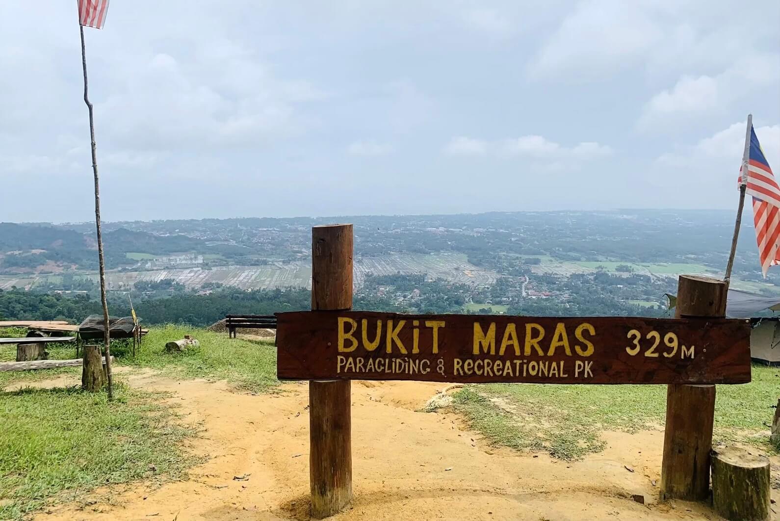
Bukit Maras is a popular local hiking spot near Kuala Terengganu and Kuala Nerus and the best part it is free.
This self-guided tour is suitable for visitors who want a moderate hike without travelling too far from the city of Terengganu. The route is commonly used by locals for morning exercise, trail run practice, and weekend outdoor activity. So it is relatively safe to go during the day, especially on weekends or public holidays if you feel safer with larger crowds.
Compared with Bukit Keluang, Bukit Maras feels more like a local fitness trail. The climb can be tiring in selected sections, but the reward is a peaceful hilltop view and a good workout. It is a practical outdoor adventure choice if you are staying around Kuala Terengganu, Batu Rakit, or Kuala Nerus.
Guided Tour: Not required. Suitable for self-guided hiking. Local guides are recommended only for the Trans 4 Puncak forest trail.
Permit Required: No permit required.
Advance Booking: Not required.
- Best for: Morning hikes and moderate trail training
- Highlights: Hilltop viewpoint and rural scenery
- Local tip: Bring enough water — exposed sections can get hot during the day.
7. Bukit Keluang, Besut
Bukit Keluang, Besut — Trail Info at a Glance
Distance from Katsetiu Villas
~40–50 min drive
Level
Beginner–Intermediate (some rope-assisted steep sections)
Elevation
183 m
Trail Distance
1.9 km • up to 1 hr 15 min
Fee
Free
Guided Tour / Self Tour
Self Tour — well-marked trail, no permit required
Opening Hours
No advance booking needed
Google Reviews
4.6 — Google Maps
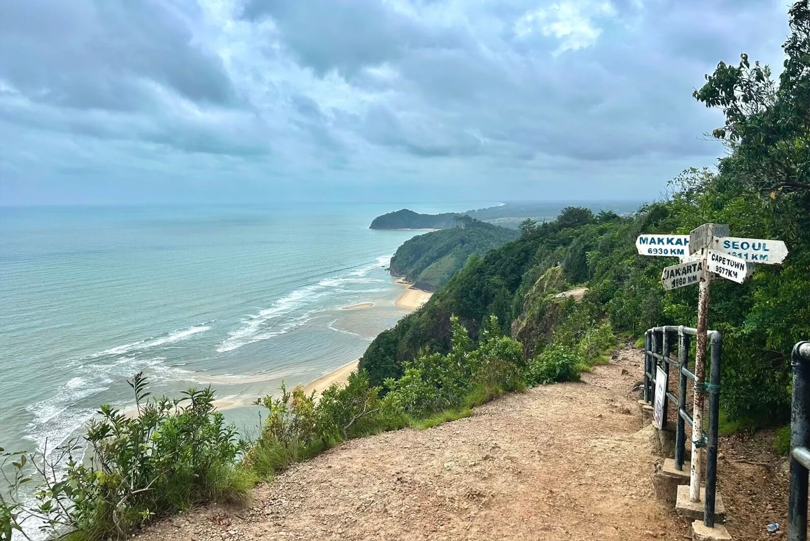
Bukit Keluang is one of the most scenic and accessible hiking spots in Terengganu. Located 4 km from Kuala Besut, this coastal hill is popular for its short climb, ocean views, rocky formations, and beach setting.
Tourism Terengganu describes Pantai Bukit Keluang as having rocky outcrops and small caves, with walkways built for access to the top of the hill where visitors can enjoy open views of the South China Sea, Pulau Redang, Lang Tengah Island and Pulau Perhentian in the background.
This is a great choice for beginners, families, and casual travellers who want a quick hike without committing to a full-day jungle trek. The highlight is the viewpoint overlooking the sea, especially during clear mornings.
Many visitors combine the hike with a beach picnic or a short stop in Kuala Besut. The place is the best hiking spot if you are staying in Setiu, near Merang Jetty or near Penarik area.
Guided Tour: Not required. The trail is well-marked and suitable for self-guided hiking.
Permit Required: No permit required.
Advance Booking: Not required.
- Best for: Hill top sea views and scenic photography sessions
- Highlights: Coastal viewpoints, rocky outcrops, and views of the South China Sea and Pulau Perhentian
- Local tip: Go early morning to avoid heat and the stronger midday sun.
8. Bukit Tok Salai, Sungai Nerus
Bukit Tok Salai, Sungai Nerus — Trail Info at a Glance
Distance from Katsetiu Villas
~40–50 min drive
Level
Beginner
Elevation
160 m
Trail Distance
~2 km one-way to the peak • 30–40 min ascent
Fee
Free
Guided Tour / Self Tour
Self Tour — well-marked trail, no permit required
Opening Hours
No advance booking needed
Google Reviews
4.4 — Google Maps
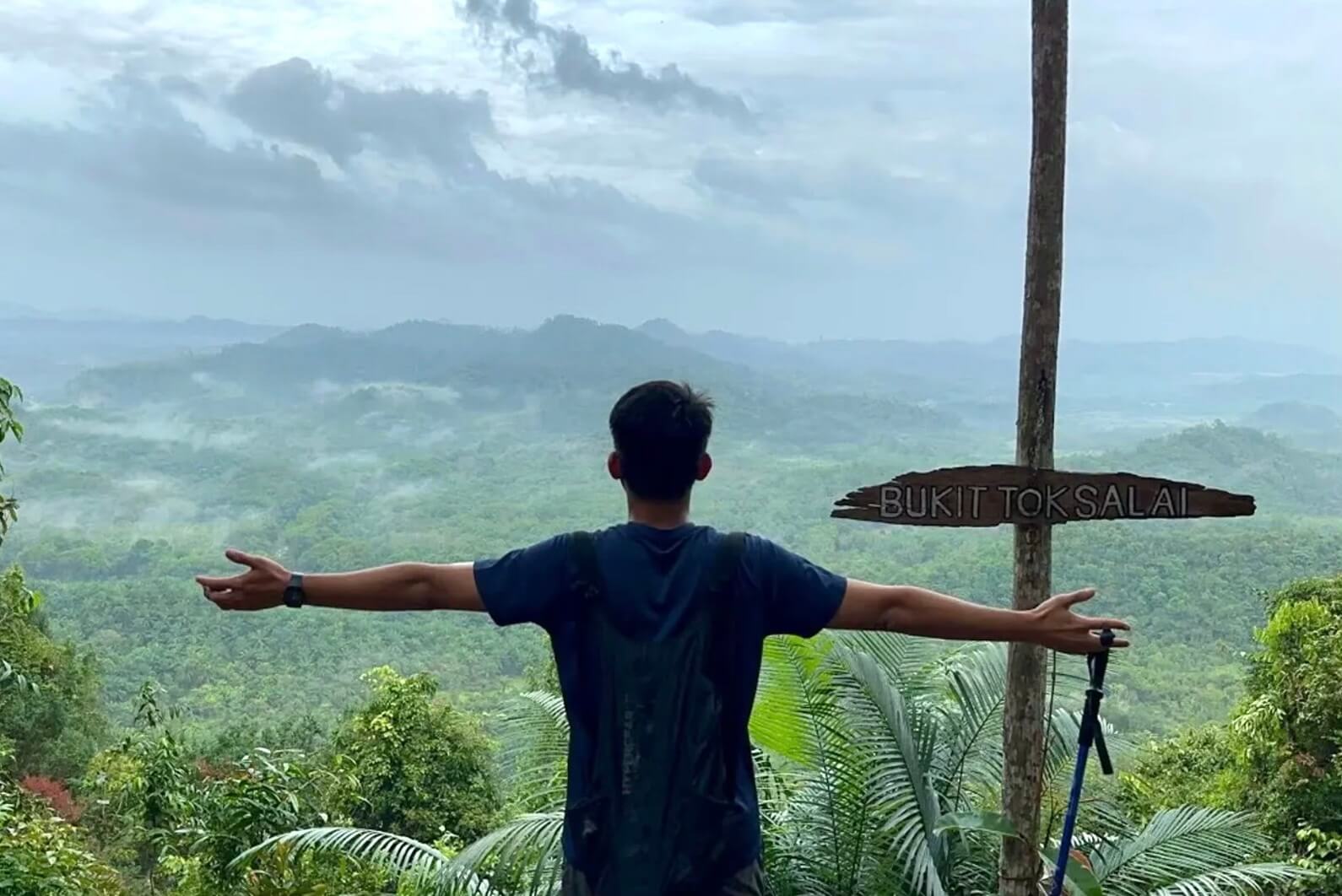
One of Kuala Terengganu’s newer hiking spots, Bukit Tok Salai only opened to the public in September 2021 but quickly drew large crowds thanks to its easy free access, no permit required to enter the forest hike and rewarding summit views.
The 4km trail is a bit steep in certain sections but manageable for most fitness levels, making it a popular sunrise and sunset spot for locals and beginners.
Because of the distance and short route, Bukit Tok Salai hiking is the amongst the best outdoor adventure attraction for short visit (eg: 3D/2N) to Terengganu, or if you plan to fill up your time after your Redang island snorkeling trip.
Guided Tour: Not required. The trail is well-marked and suitable for self-guided hiking.
Permit Required: No permit required.
Advance Booking: Not required.
- Best for: Sunrise chasers, cloud-sea (awan karpet) views, and a quick city-adjacent hike
- Highlights: Panoramic views over settlements, plantations, and the Nerus River, plus carpet-cloud views on clear mornings
- Local tip: Opened to the public in 2021 and gets crowded on weekends; no facilities on the trail, so bring your own water.
9. Bukit Besar Hiking Network, Kuala Terengganu
Bukit Besar Hiking Network, Kuala Terengganu — Trail Info at a Glance
Distance from Katsetiu Villas
~45–55 min drive
Level
Beginner–Intermediate
Elevation
Varies by trail and peak
Trail Distance
Multiple routes, ~2–8 km • 1–3 hrs
Fee
Free
Guided Tour / Self Tour
Self Tour — a GPS hiking app is useful for the lesser-used forest trails
Opening Hours
No advance booking needed
Google Reviews
No aggregate rating published for the trail network as a whole — check individual peaks (Bukit Rohok, Bukit Botok, Bukit Tobak) on Google Maps
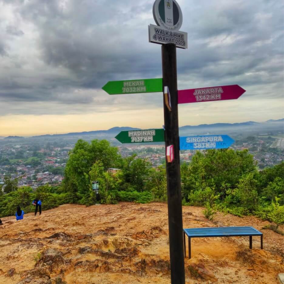
Bukit Besar is the most popular forest hiking destination in Kuala Terengganu (nearest to the city), offering an extensive network of interconnected trails suitable for hikers of all experience levels. The best part it is free! Yes, no permit required to enter or explore the forest.
Rather than being a single hill, the area comprises several linked peaks, including Bukit Rohok, Bukit Botok, and Bukit Tobak, each providing slightly different terrain and viewpoints.
The hiking network features a mix of paved access roads, shaded forest trails, steep climbs, and scenic viewpoints overlooking Kuala Terengganu and the surrounding coastline.
Whether you’re looking for a leisurely morning walk, a fitness workout, or a more challenging trail run across multiple peaks, Bukit Besar offers a variety of routes to suit every preference. Its convenient location and diverse trail options have made it a favourite gathering place for local hikers, runners, and outdoor enthusiasts throughout the year.
Guided Tour: Not required. The interconnected trail network is suitable for self-guided hiking, although first-time visitors may find a GPS hiking app useful when exploring the lesser-used forest trails connecting Bukit Rohok, Bukit Botok, and Bukit Tobak.
Permit Required: No permit required.
Advance Booking: Not required.
- Best for: Casual hikers, fitness enthusiasts, and trail runners
- Highlights: Interconnected hiking trails, Bukit Rohok, Bukit Botok, Bukit Tobak, telecommunications tower, forest trails, panoramic city views, and sunrise viewpoints
- Local tip: There are several trail options ranging from easy paved roads to steeper jungle routes. Wear proper hiking shoes if exploring the forest trails, especially after rain when some sections can become muddy and slippery.
Additional Notes
- Multiple Peaks: The Bukit Besar hiking network connects several popular hills, including Bukit Rohok, Bukit Botok, and Bukit Tobak, allowing hikers to customise their route based on experience and fitness level.
- Urban Hiking Destination: Located just minutes from Kuala Terengganu city centre, Bukit Besar is one of the state’s most popular spots for morning exercise, jogging, trail running, and weekend hikes.
- Flexible Routes: Beginners can enjoy the easier paved road leading to the telecommunications tower, while more experienced hikers can tackle the interconnected forest trails linking the surrounding peaks.
10. Bukit Chendering, Kuala Terengganu
Bukit Chendering, Kuala Terengganu — Trail Info at a Glance
Distance from Katsetiu Villas
~50–60 min drive — at the edge of the one-hour mark
Level
Easy–Intermediate
Elevation
~38 m
Trail Distance
1 km out-and-back • 15–30 min
Fee
Free
Guided Tour / Self Tour
Self Tour — well-marked trail, no permit required
Opening Hours
No advance booking needed
Google Reviews
4.4 — Google Maps
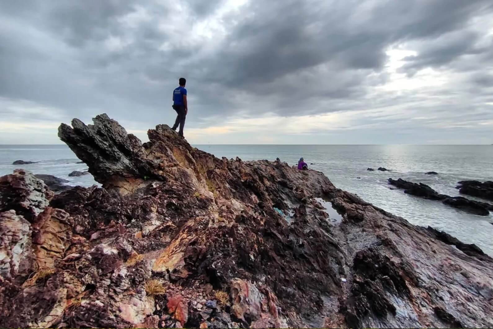
Nestled along the coast in Chendering, Bukit Chendering is a short yet rewarding hike that combines forest trails with stunning seaside scenery. Despite its relatively short distance, the route includes several steep climbs and rope-assisted sections, adding a touch of adventure before opening up to panoramic views of the South China Sea and the rugged coastline around Pantai Pandak.
Its convenient location, scenic viewpoints, and manageable duration make Bukit Chendering a popular choice for those seeking a quick outdoor escape without venturing far from Kuala Terengganu. Whether you’re looking for a morning workout, a peaceful sunrise hike, or a scenic photography spot, this coastal hill offers an enjoyable adventure in under an hour.
Guided Tour: Not required. The trail is well-marked and suitable for self-guided hiking.
Permit Required: No permit required.
Advance Booking: Not required.
- Best for: Casual hikers, photographers, and sunrise seekers
- Highlights: Coastal viewpoints, rope-assisted climbs, and views of Pantai Pandak and the nearby lighthouse
- Local tip: The trail can be slippery after rain, particularly on the steeper sections. Wear shoes with good grip and visit early in the morning or late afternoon to avoid the heat.
Additional Notes
- Short but Exciting: Although the hike is less than 1 kilometre each way, several steep sections are equipped with ropes to assist hikers during the climb.
- Coastal Scenery: The summit and surrounding viewpoints offer beautiful vistas of Pantai Pandak, the South China Sea, and the nearby lighthouse.
- Popular Recreation Spot: Bukit Chendering is a favourite among locals for morning hikes, jogging, photography, and enjoying the sea breeze.
FAQ: Why Apply Permit?
While it seems troublesome to apply for a permit just to have a relaxing hike, we need to understand the importance of permit application in Malaysia forest reserve:
- To maintain the beauty and quality of the forest and hiking trails: In order to avoid damaging the natural landscape, some forest trails limit the number of hikers to reduce the impact on the environment. As much as we love nature, did you know that hiking actually damages the environment? Each step we take in the forest contributes to soil erosion, muddiness, vegetation damage, trail extension and widening. The permit application ensures that the number of visitors in the forest does not exceed the quota.
- For your own safety: The involvement of permit applications and police reports let the authorities know when you are entering the forest and what time you would be expected to exit.
- For insurance claims in the event of an accident: Having a forest permit is vital when making a police report to claim for the insurance.
- To be updated and advised on the forest trail: The forestry officers will inform you on any maintenance work or trail closure due to natural disasters (eg. landslides or fallen trees). For safety reasons, the forest may also be inaccessible by the public during windy or monsoon
seasons. - To be a law-abiding citizen: From time to time, we see news reports of hikers getting caught entering forest reserves without a permit. Anyone caught entering a permanent forest reserve without a permit is subject to legal action under the National Forestry Act 1984, which includes a fine up to RM10,000 or a 3-year imprisonment. Let’s all be a good responsible hiker, and not give hiking a bad reputation.
⚠️ Tips Before You Hike
- Season: Avoid hiking during the Northeast Monsoon (November–March) as it brings heavy rain to the east coast of Peninsular Malaysia, including Terengganu.
- Permits: Under the National Forestry Act 1984, any recreational activity inside a gazetted Hutan Simpanan Kekal (Permanent Forest Reserve) requires an entry permit (typically RM5 per person) from the Terengganu Forestry Department (JPNT) or the relevant Pejabat Hutan Daerah, applied for at least a week in advance. This applies to Gunung Tebu, CBL, Gunung Gagau, the Lawit Range, Bukit Batu Kapal, Air Terjun Berdebu, and Lata Ulu Kasar. Most of the low-lying urban and coastal hills in this guide (e.g. Bukit Besar, Bukit Keluang, Bukit Bubus, Bukit Chendering, Bukit Maras) sit on state or local-council land rather than gazetted forest reserve, so they don’t require a JPNT permit — but always confirm locally, as boundaries and requirements can change.
- Gear: Proper hiking shoes, sufficient water supply, and mosquito repellent (especially at Bukit Mentok and Bukit Bubus).
- Best time: Start early in the morning (before 7am) for shadeless trails like Bukit Jelutong and Bukit Bubus, to avoid the midday heat.
Hiking Safety Tips in Terengganu
1. Choose a trail that matches your fitness level
Pick a hiking route based on your experience and stamina. Bukit Keluang, Bukit Besar, and Melunak Trail are more suitable for beginners or casual travellers, while Gunung Tebu and CBL are better for experienced hikers.
2. Check the weather before hiking
Always check the weather forecast before your trip, especially for waterfall routes, island trails, and lake-based activities. If heavy rain is expected, postpone your hike for safety.
3. Be extra careful during the monsoon season
The Northeast Monsoon from November to March usually brings heavier rainfall to the east coast of Peninsular Malaysia, including Terengganu. Trails can become slippery, rivers may rise quickly, and waterfall areas can be dangerous after rain.
4. Check permit requirements in advance
Some trails, especially those inside forest reserve areas, may require permits. For example, hikers interested in CBL should check with the Terengganu Forestry Department before going.
5. Prepare basic hiking essentials
Bring enough drinking water, light snacks, insect repellent, a rain jacket, proper hiking shoes, a charged phone, and a basic first aid kit.
6. Start early and avoid hiking alone
For longer or more challenging hikes, start early in the morning and hike with a group or local guide. This is especially important for forest, mountain, and waterfall trails.
7. Take extra care on island and coastal trails
For trails such as Bukit Singa, check tide and sea conditions before hiking. Avoid slippery rocks, unstable edges, and cliff areas, especially after rain or during strong winds.
8. Follow guide instructions on rainforest and lake trails
For lake and rainforest experiences such as Melunak Trail, follow the guide’s instructions and stay with the group. Avoid wandering away from the marked trail, as rainforest areas can be muddy, slippery, or easy to get lost in.
Note: Elevation and distance figures for some smaller hills may vary slightly across sources due to inconsistent measuring points. Always check the latest information with the Terengganu State Forestry Department or local hiking communities before planning your trip.
Ready to Explore Terengganu's Wild Side?
Whether you’re chasing a crystal-clear river pool, a sunrise above the clouds, or the challenge of reaching one of Terengganu’s highest peaks, there’s a trail for every type of adventurer within easy reach of Katsetiu Villas. From family-friendly rainforest walks at Blue Pool and Lata Ulu Kasar to rewarding mountain hikes like Gunung Sarut, the region offers countless opportunities to reconnect with nature beyond its famous beaches.
After a day on the trails, return to the comfort of Katsetiu Villas to relax, recharge, and wake up ready for your next adventure. With several of these hiking destinations located less than an hour’s drive away, Katsetiu Villas makes an ideal base for exploring the quieter, greener side of Terengganu.